Land Use Plan for UBC South Campus Farm
The Land Use Plan for the UBC Farm includes detailed documents and maps of what the farm looks like today as well as potential future uses. It includes aerial maps of the current land cover, current use (conservation, crop production, buildings, access etc.), and future use. Below are some of the current maps used in the Land Use Plan with aerial photos courtesy of VanMap.
UBC Farm Boundary
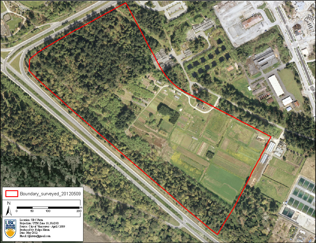
UBC Farm Boundary
UBC Farm Land Cover
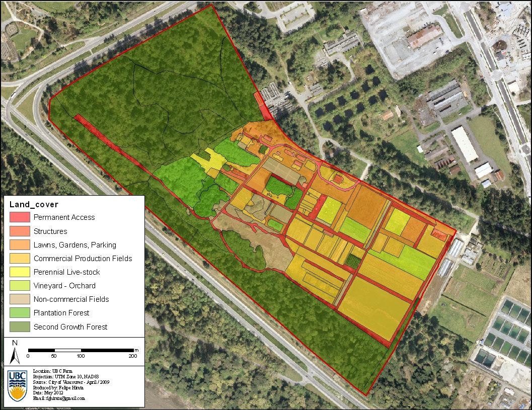
UBC Farm Land Cover
UBC Farm Land Use
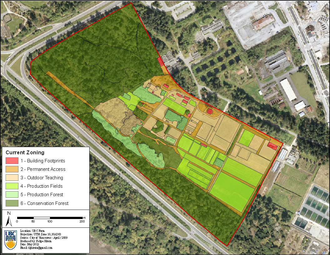
UBC Farm Land Use
UBC Farm Forest Cover
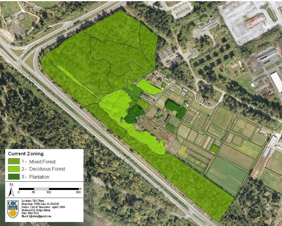
UBC Farm Forest Cover